Mount Tamalpais is our backyard. Visible from most of San Francisco on a clear day, it’s Marin County’s dominating topographical feature. Offering no less than four paved routes from sea level to its 2,572ft summit, it’s also (ostensibly) the birthplace of mountain biking. In that regard, the mountain is a long-standing object of controversy and trail-use battles between user groups. The ironic result, considering the history of the place? Most singletrack on our local hill is off-limits to the knobby-tired crowd.

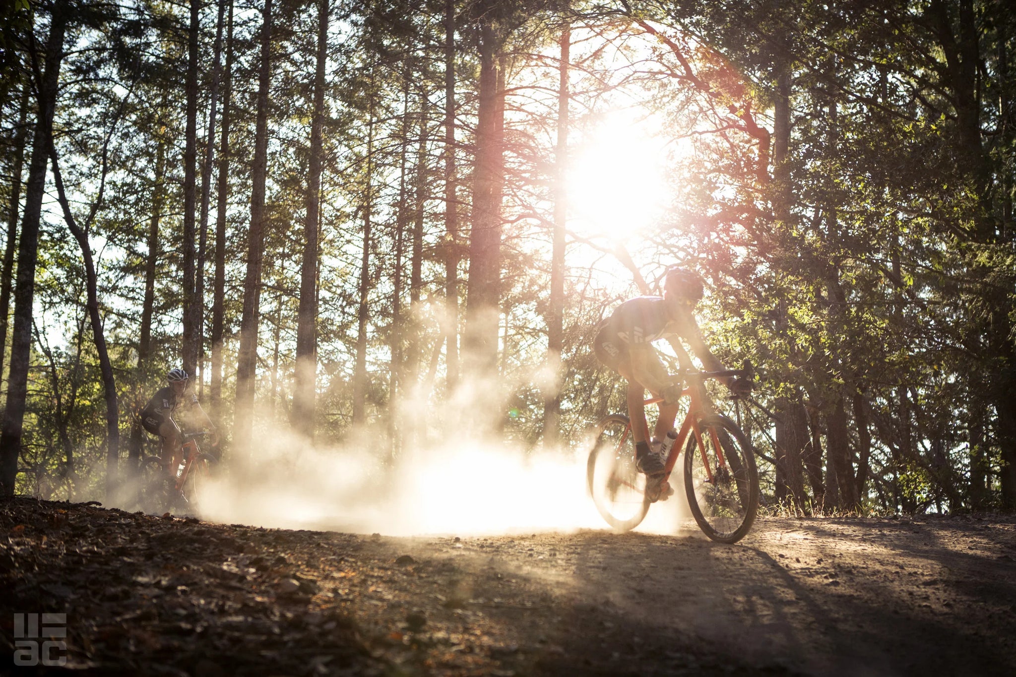
While the narrow, technical riding favored by most mountain bikers is limited on Tam, the opposite is true when it comes to wide, relatively easy fire roads – the kind that our latest crop of gravel bikes excel at. The hill is criss-crossed by these kinds of rough access roads, and with lightweight, drop bar bikes equipped with disc brakes, low gears, and fatter tires, ride options free of cars offering expansive new vistas to what was always hiding under our noses becomes apparent. We won’t lie – we’ve taken our fair share of road racing bikes on a number of these gravel routes. The climbing aspect of most is certainly attainable on skinny tires (tubulars, even), but descending is where we’ve often found ourselves a bit under-gunned. It’s where bikes like the Open UP and Mosaic GT-1 excel, armed with 40mm tubeless rubber, and hydraulic braking that make the downhills less of a white-knuckle experience, and more of a “hooting with glee” enterprise.

We’d like to present our latest exploration on the backside of Tam with just such a bike, Open Cycle’s UP(short for Unbeaten Path). We have two routes, one (B Route) clocking moderate difficulty (aerobically and technically), with about 2-3hrs of ride time, depending on fitness level. The other? It’s hard, with several leg-breaking climbs, technical sections, and plenty of California’s omnipresent poison oak. It’s also the far more rewarding of the two, with spectacular views and fantastic riding through a shrouded redwood rain forest, where one might expect an Ewok to pop out at any moment in time. Expect 3.5-5hrs of riding time for the “A Route”.

RECOMMENDED EQUIPMENT
Gearing: At least 1/1 low gear (eg, 42t chainring/42t large cog, 34t/34t, etc.). Several sections with gradients averaging 10-20% on dirt. We rode this on a SRAM 1×11 setup with a 42t chainring and 10-42t cassette, and at times were wishing for something even a touch lower. Tires: 35mm+, tubeless, durable. Knobbies optional. Most of the dirt on the route is either hardpack or fairly grippy loam, and the volume of a tire like the slick Maxxis Refuse in 40mm or 27.5×2.0″ is optimal while still affording fast rolling/giggly descending on the paved segments of the ride. Water/Food: Lots, depending on heat. Unlike road rides we’re accustomed to, there are few stops for refills on the route, and those that are available typically require detours. A third bottle isn’t a bad idea, if room permits. GPS: Preferred. Getting lost might be a bit too easy.

THE RIDE
Both start at one of our favorite local coffee spots, Equator Coffee in downtown Mill Valley, just up the road from Above Category in Sausalito.
A Route (GPX FILE LINK): Start the day climbing out of Mill Valley on Old Railroad Grade, a former route used by the defunct-since-1930 Mount Tamalpais and Muir Woods Railway to haul tourists to the summit of Mt. Tam on a narrow-gauge steam railroad. Given that, the grade of the dirt road is quite tame – 5-7% at the most, making it easy to keep energy consumption in check, which is definitely going to be needed for the latter half of the ride. As it wends its way up the mountain, it briefly revisits pavement on Fern Canyon Road about two miles/three kilometers in, and quickly turns back to dirt. Jaw-dropping views back onto southern Marin County, downtown San Francisco, and the San Francisco Bay are plentiful. On especially fog-free days, sight lines to the Bay Area’s other prominent peaks, Mt. Diablo and Mt. Hamilton, are visible to the southeast. The first half of Old Railroad Grade can be slightly bumpy/rocky, but it mellows as the road climbs.

On approach to the summit, hang a right around the venerable West Point Inn for the final push to the top of Tam. Old Railroad Grade terminates on Ridgecrest Boulevard (paved), just below the East Peak of Mt. Tam. Taking a right on Ridgecrest for both the view from the summit, as well as a Coke from the vending machine (that takes credit cards) and a water top-off is advisable. Roll back down Ridgecrest off the summit, and cross the West Peak of Tam, staying on the paved descent for about a mile (1.6km), until a sharp righthand turn onto the Rock Springs-Lagunitas fireroad (there’s a small gate paralleling the road). Two quick, steep pitches uphill are followed by the long, thrilling descent off the backside of Mt. Tam. The surface here is, depending on the last time it was graded, soft and exceedingly fun. There are plenty of small hips shaped into the road (designed to slow trucks descending the road) that offer a natural terrain park with perfect transitions, if that’s your thing. About 1.8 miles (3km) down the descent, follow a sharp left turn onto the Rocky Ridge fireroad, where the road steepens and becomes significantly more technical with sweeping vistas of the heavily wooded Tam watershed to the left, and out to the right into Sonoma County. The descent towards Bon Tempe Lake significantly steepens, with the most technical aspect of the ride – keep speed in check here, as there are some looser corners that can sneak up on the rider.
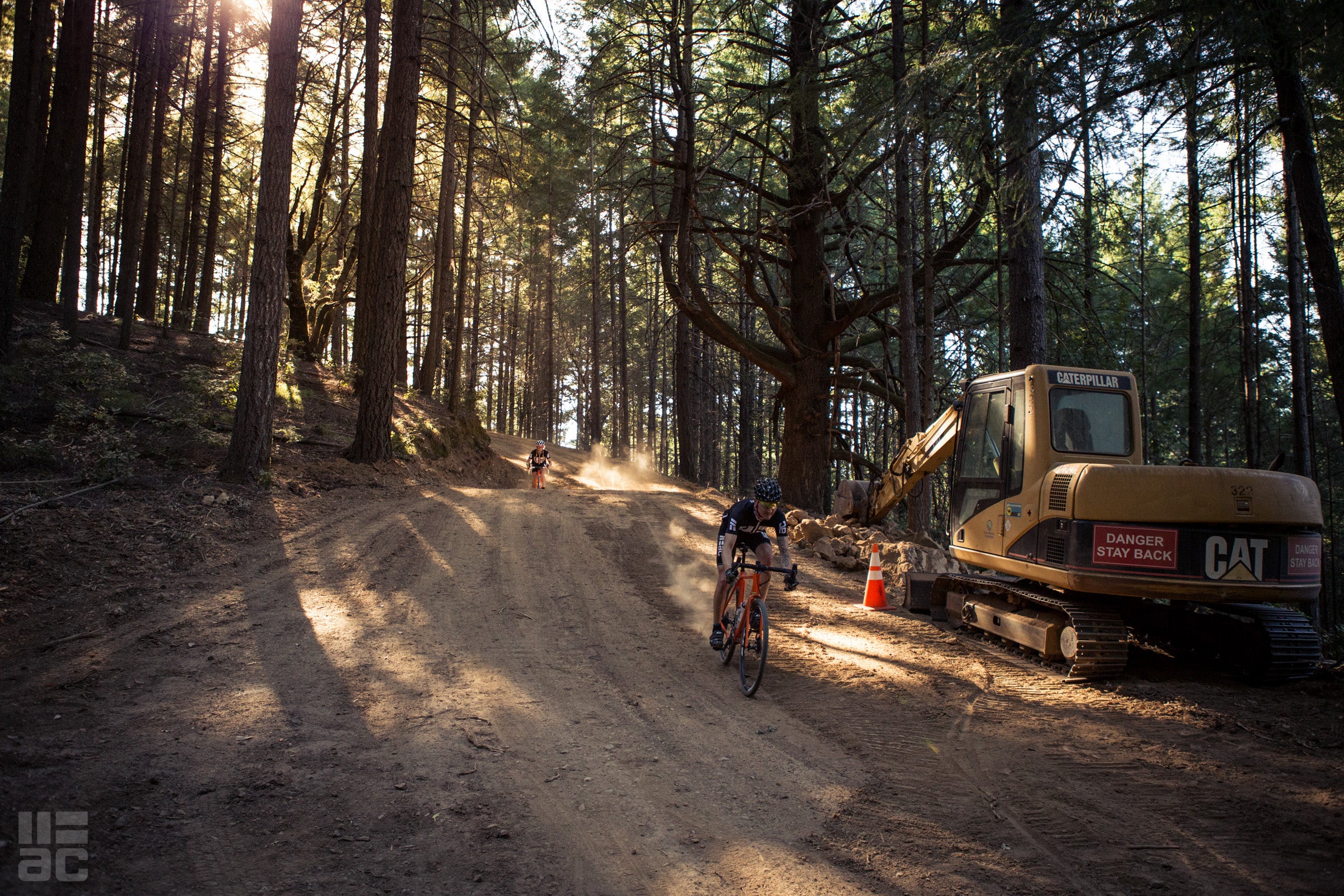


Cross Bon Tempe dam, and take a left down alongside the spillway. Follow the fire road until it deposits itself onto singletrack and a boardwalk, then take a left at the fork in the trail to parallel the Meadow Club golf course, where it will drop out at the clubhouse. On the right, before the dirt hits the pavement, there’s a water fountain free to use to top off bottles. If you’re familiar with riding in the area, you’ll recognize the road ahead – Fairfax-Bolinas, the route to Alpine Dam. Hang a left on the pavement to climb Pine Mountain, savoring the mild grade before the punishment that lies ahead. As the road tops out on Pine Mountain with an unpaved parking lot on the left, jump right again onto more dirt, the Pine Mountain fireroad. It’s here where punishment lies. The first 500 meters is fairly unassuming, though significantly more rocky than the previous dirt traverses. Looking ahead, one can gaze upon the terrifying pitches ahead, lying in wait for victims. The road populates with loose rocks the size of cabbages, and a 20%+ grade makes getting bounced off-line a foregone conclusion. At some point, without serious motivation, one will get off. And one will commit the walk of shame.


The route cruises along the San Geronimo Ridge, undulating several more times, with sweeping vistas off either side of the eponymous dirt road. On approach to the looming redwood forest, a four-way intersection. Continue straight, and gut out the short 13% climb around Green Hill. As the road sweeps through the forest, the name of the game is momentum – keep speed on the descents to hit the next short wall with minimal effort. In two miles (3.3km), the trail abruptly drops to the right for a screaming, loamy descent into the overgrown heart of Marin at Sir Francis Drake Boulevard and Lagunitas Creek. Now is an excellent time to stock up on calories and water, and the tiny Lagunitas Grocery lies a mere one mile to the right (west) from the bottom of the San Geronimo Ridge Route. The route itself continues right where it left off – cross the bridge to the left over the Lagunitas Creek, and follow signs for Shafter Grade. You, dear rider, are about to enter a world of pain. Roll through the gate in front of you, enjoying the lush greenery. Within a few short minutes, one will encounter a fork in the easy, lolling road. The fork to the left would appear to be the sane route – and you’d be correct. Which is why you’re going to turn right, up the 20% concrete wall in front of you, the one with perpendicular traction grooves carved into the surface. Welcome to Shafter Grade. It’s a 1.2-mile (2km) dirt ascent that gains 1150ft (350m)at a 14% average. It hurts, especially the first half. It’s one of those hills that actually feels good when the grade relaxes to 8%. You’ve been warned.

The climb relents, and our route takes you left onto one of Marin’s legendary chunks of trail: Bolinas Ridge. Bo’ Ridge rips through a redwood rainforest in a scene out of Return of the Jedi. It’s fast, with some short steep uphill bits, but incredibly rewarding. Even in the hottest parts of the year, parts of it can be quite muddy thanks to fog condensing on the limbs of the massive trees looming overhead. With a stunning overlook of the Pacific Ocean and Mt. Tamalpais to the southeast, Bolinas ridge drops to the intersection with vaunted road climb BoFax, and the base of the Seven Sisters portion of Ridgecrest Boulevard.

For locals, the remainder of the route is fairly straightforward, ascending Seven Sisters on pavement, a right at the Rock Springs parking lot below the final ascent of Tam, and then a left at the ranger station on Panoramic Highway for the fast paved descent back to Mill Valley.
B ROUTE (GPX FILE LINK): Follow the A Route until the boardwalk/singletrack past Bon Tempe Dam, and before the Meadow Springs golf course. Instead of bearing left at the singletrack fork, go right. Follow Sky Oaks Road until it dives into the woods again, where a left turn onto a wide, dirt road (Shaver Grade) will present itself. Go around the gate, and follow the wide, smooth dirt down to Lagunitas Road in the community of Ross. From there, the route is the familiar cycling highway of Marin and completely paved, eventually taking the rider over Camino Alto and back into Mill Valley.
Thanks for reading! Questions? Comments? Email us.


Back to Rides