Looking incredulously at the chicken and waffles placed in front of my gaping maw, I wonder how I got here. By here, I mean this prototypical breakfast spot in a prototypical coastal California burg. Incredulous? It's because my chicken and waffles have been made with drumsticks. I am an unabashed waffle whore, and the perfect marriage of a briny, breaded, crispy slab of boneless chicken to a toasty waffle with maple syrup laced across the assembly is a perfect salty/sweet dreamboat when cut in unison, and consumed in unison. I vent my rage in the most millennial way I know.


DAY THREE: SANTA BARBARA TO LOS OLIVOS - 132KM / 3624M
Santa Barbara is an idyllic place with an idyllic downtown and idyllic restaurants, mostly perused by the 50-75 demographic. While UC Santa Barbara shares the name, it is, in fact, sequestered ten miles to the west in Goleta, where burning couches atop U-Hauls in annual end-of-semester Isla Vista diasporas can be demonstrated in relative isolation, far away from the tapas and art galleries of downtown. The juxtaposition between the town and its immediate natural environ continues the theme, a landscape bleak and untamed contrasted with abundant urban flora, wine bars, and coffee shops.


Wedged between towering escarpments and the Pacific Ocean on a 4km/2.5mi stretch of coastline, most wouldn't call Santa Barbara a cycling destination. Because of its dramatic topography and relatively low population density, available routes are few, but those that exist are arduous and stunning. Gibraltar Road is one such route, rising from the posh foothills of Santa Barbara 800m to the spine of the Santa Ynez Mountains at Angostura Pass. The most westerly of Southern California's barrier-like Transverse Ranges (named as such because - unlike most ranges in the US - they run east to west), they are the third of the group we will conquer, after tackling the Santa Monicas and the San Gabriels in our first two days. Gibraltar Road itself is legendary. Built in the 1930s as a WPA project (initially it was dubbed "Depression Drive"), it laces its way up the face of the Santa Ynez with the Pacific looming far below, cutting through barren, jagged strata of rock and scrub. Today, we are riding Gibraltar, and the other monstrous climb the Santa Barbara-area is known for, Figueroa Mountain.

But first, we must coffee. Enter Handlebar Coffee Roasters, founded by two former professional cyclists who stumbled upon Santa Barbara during the Tour of California in 2008. For every cyclist who comes to Santa Barbara, it is something of a religious pilgrimage.


Rolling north past the Santa Barbara mission, Gibraltar looms, its cuts visible from the base of the enormous climb. Fortunately, we're feeling far more rested than the day before, during our high-altitude jaunt in the San Gabriels. The baking sun is helping, and its temperature continues to climb throughout the day. We're actually smiling. As we make the turn onto Gibraltar itself, we lift the pace.


With a possibly first-ever fresh coat of pavement circa-2015, Gibraltar no longer resembles a warzone with Abrams-sized craters, instead a glorious ribbon of tarmac reaching up to the heavens. Its steady 7-9% average gradient is a runway for rhythm while the vista behind us swirls around our field of vision as we whip up every switchback and curve, alternating seated effort with standing.


Gibraltar tops out at El Camino Cielo (Eng: The Sky Road), a fitting name for a road, like the Angeles Crest the day before, that arcs along the spine of a mountain range. Except, unlike the Crest, Camino Cielo blasts across the ridge of the Santa Ynez with the blazing azure blue of the Pacific to the left, and the crumpled mass of the Californian interior to the right, with Figueroa's cuts looming 30 miles distant. We oblige the Sky Road, taking a ricecake handup from THE VAN, and launch ourselves down the ridge to the road's end at Highway 154.


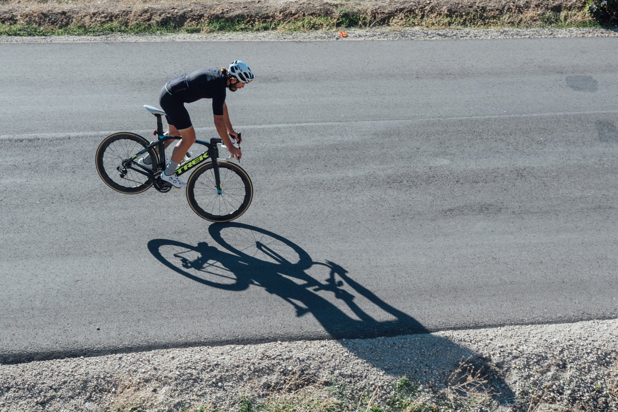


It was here that things would become interesting. We originally intended to take a dirt descent off the backside of the mountains in order to reach Figueroa Mountain, because road racing bikes with tubulars really belong in such conditions. Unfortunately, because of THE VAN and its inability to hop gates as proficiently as us, we are constrained to pavement, and 154 is an especially dicey segment of such, providing us ample opportunity to make use of our daytime running lights, as well as practice our 90kmh aero tucks to the valley floor. A major artery, 154 lacks a shoulder, offers a 55mph speed limit, and plenty of opportunities for being buzzed by traffic. Needless to say, we don't recommend using it as the connector to Figueroa.


Escaping 154, we approach the base of the backside of Figueroa in splendid isolation, with solitary oak trees standing guard over a calm country road. It is the first time during the journey that we've felt alone, and it is incredible. After the stress of staying alive on 154, we have been transported into another dimension on the appropriately named Happy Canyon Road.


The heat begins to set in. Our SRM headunits tell the story as the mercury begins to crack 95°F. All three of us are pounding water at an exorbitant rate. I ditch my helmet in THE VAN. Kemi takes off her jersey. Tony festers. We are beginning to melt. The climb begins in earnest, narrowing to a mere eight or nine feet wide.


Figueroa Mountain's backside juts up 700m/2200ft in 8.5km/5.2mi. It is fully visible from the top of Gibraltar, far in the distance. While not as dramatic as Gibraltar, the heat has made it more difficult, and the landscape has once again shifted. Gone are hillside mansions and lost communes of the 70s, instead we are visiting the wrath of nothingness. Figueroa goes nowhere, except over the top of the mountain. Yet still, a 1988 Chevorlet Nova has made it this far, puttering past us as we ascend into a draw, waiting for the Sand People to shuffle out of their hiding places. It is the second car we've seen since turning onto Happy Canyon Road. As we pivot on Figueroa's hairpins, I feel a course of energy pulse through my body. We are approaching 4.5 hours on the bike, and I am feeling the need to drop the hammer. It is confusing, and possibly dehydration-induced delirium, but I hit it anyway, feeling the incorruptible waves of pain slosh against the insides of my legs. The beauty is astonishing, the curves of the road lined up in the distance, one after the other, cut into the side of the exposed mountainside. The van is nowhere in sight, and I'm yearning for photographic record of this road - this hill. It is a confusing place, this, the desire to keep a chunk of the suffering for posterity. I reach the top solo, and turn around, in search of Erik, Embry, and Nick, THE VAN's entourage. I locate them 1500m down the mountain. We make another go at it, and I lay into the remainder of the climb at a pace I no longer unearth enough anymore - "FULL GAS".


At the top, the band is reunited. Tony's salt patina is thick enough to cure bacon with. Kemi is shattered. It is hot. We pound three Cokes each, slam water, and hit the descent. Our objective, at the end of the day, is a winery just outside of Santa Maria, but we are running short on time.


It is incomparable. The descending road weaves through sunburned meadows on its way to the flatlands like a skier caressing twelve inches of freshies, careening into an abyss only Michael Jackson could dream of. As we descend, I make a mental note that we picked the best way up. The deserted way. We rocket past picnickers at the gate of Neverland Ranch while taking tempo paceline turns, attempting to make our destination by nightfall. I pull out my phone, glance at the map. It isn't to be. We still have 40km to go, and daylight is fading fast. Luckily, Firestone Winery is just ahead - and still open. We turn around to seek out THE VAN, some twenty minutes behind, thanks to the twisty descent off Figueroa.
Van is located. We don't #getinthevan. We ride to Firestone. Nick wanders in, chats up the staff, and reappears five minutes later with four bottles of white and a spread befitting a caravan of Japanese tourists. We eat. Nay, gorge. We #getinthevan, and begin the hour-long drive to Cambria under the cover of darkness.




Back to Journal